

Topographical and land cover maps

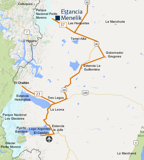
Coming down National Highway Nº 40 you go through the town of Bajo Caracoles until you reach the crossing to Las Horquetas. Up to this point the road is paved, from here to Menelik the road is gravel. From the crossing take Provincial Highway Nº 37 towards the Andes Range; from here it is 80 km. (49.7 miles) to the Estancia.
Head north along National Highway Nº 40 from El Calafate until you come to Las Horquetas crossing. From there you take the Provincial Road Nº 37. Highway Nº 40 is all paved with the exception of a 70 km. (43.5 miles) sector between Tres Lagos and Lake Cardiel.